
Itinerari i Trashëgimisë Kulturore – GET
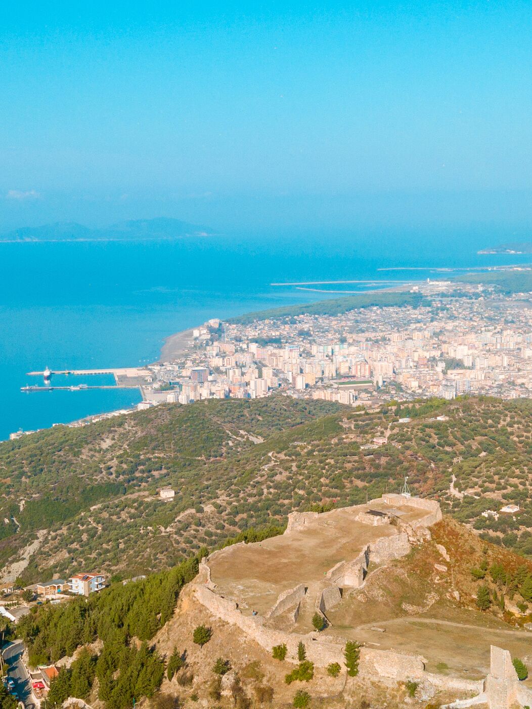
Nga gjiri i Vlorës te Butrinti, ky itinerar përmbledh 38 monumente dhe vende të trashëgimisë kulturore të Qarkut Vlorë – qytete antike, kala, kisha, xhami, manastire dhe fshatra prej guri – sipas udhëzuesit kulturor të projektit GET – GRALB Experience Tourism, të realizuar në kuadër të Programit Ndërkufitar IPA II Greqi–Shqipëri 2014–2020, me Këshillin e Qarkut Vlorë si partner.
From the Bay of Vlorë to Butrint, this itinerary presents 38 monuments and heritage sites of the Vlorë Region – ancient cities, castles, churches, mosques, monasteries and stone villages – based on the cultural guidebook of the GET – GRALB Experience Tourism project, implemented under the IPA II Cross-border Cooperation Programme Greece–Albania 2014–2020, with the Regional Council of Vlorë as a partner.
⬇ Shkarko guidën e plotë (PDF, 8,8 MB, anglisht)Download the full guidebook (PDF, 8.8 MB)
Vlorë (Aulona)Vlorë (Aulona)
Vlora, e njohur në antikitet si Aulona, është qyteti ku më 1912 u shpall Pavarësia e Shqipërisë. Rreth gjirit të saj ndodhen qytetet antike të Amantias, Olympes dhe Treportit, kalaja e Kaninës dhe manastiri i Zvërnecit.
Vlorë, known in antiquity as Aulona, is the city where Albania’s independence was proclaimed in 1912. Around its bay lie the ancient cities of Amantia, Olympe and Treport, Kanina Castle and the monastery of Zvërnec.
Manastiri i ZvërnecitZvërnec Monastery
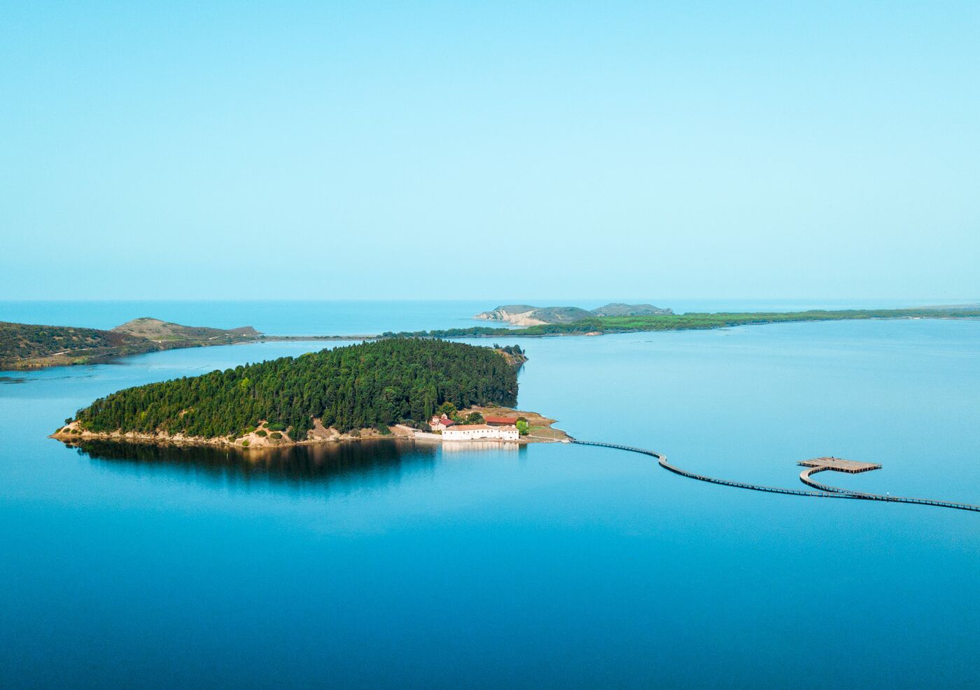
Kisha e Shën Marisë, e shekujve XIII–XIV, ngrihet në një ishull të vogël pranë fshatit Zvërnec dhe lidhet me tokën me një urë druri. Dallohet për proporcionet, fasadat me harqe dhe kupolën mbi tambur; ikonostasi prej druri është i gdhendur me motive bimore dhe shtazore. Më 15 gusht, ditën e Shën Marisë, ishulli mbushet me besimtarë nga fshatrat përreth.
The 13th–14th-century Church of St Mary stands on a small island near the village of Zvërnec, linked to the shore by a wooden bridge. It is admired for its proportions, arcaded façades and dome on a drum; the wooden iconostasis is carved with floral and animal motifs. On 15 August, the Feast of the Dormition, the island fills with pilgrims from the surrounding villages.
Xhamia e Muradies dhe muret e AulonësMuradie Mosque and the walls of Aulona
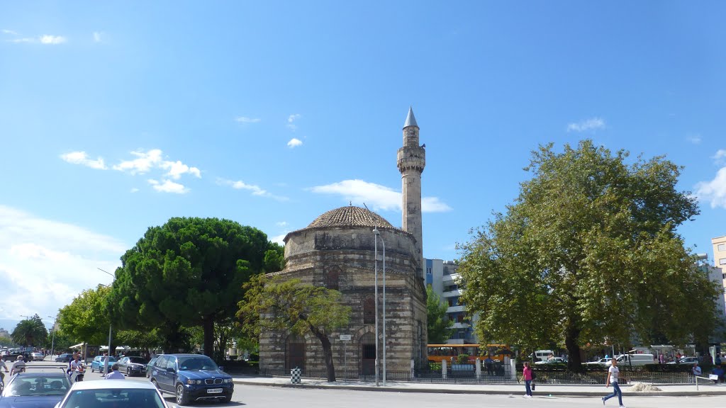
Xhamia, e ndërtuar më 1537 dhe e lidhur me arkitektin e famshëm osman Mimar Sinan, ka një sallë lutjeje kubike me kupolë dhe minare 18 m të lartë. Muret me rreshta guri e tullash të kuqe janë tipike për ndërtimet e tij. Pranë saj, fragmente të një kështjelle të shekullit VI dëshmojnë për Aulonën e lashtë, të përmendur që në shekullin II.
Built in 1537 and attributed to the great Ottoman architect Mimar Sinan, the mosque has a cubic, domed prayer hall and an 18 m minaret. Its walls of alternating stone and red-brick courses are typical of his work. Nearby, fragments of a 6th-century fortress recall ancient Aulona, mentioned as early as the 2nd century AD.
Kalaja e TreportitTreport Castle
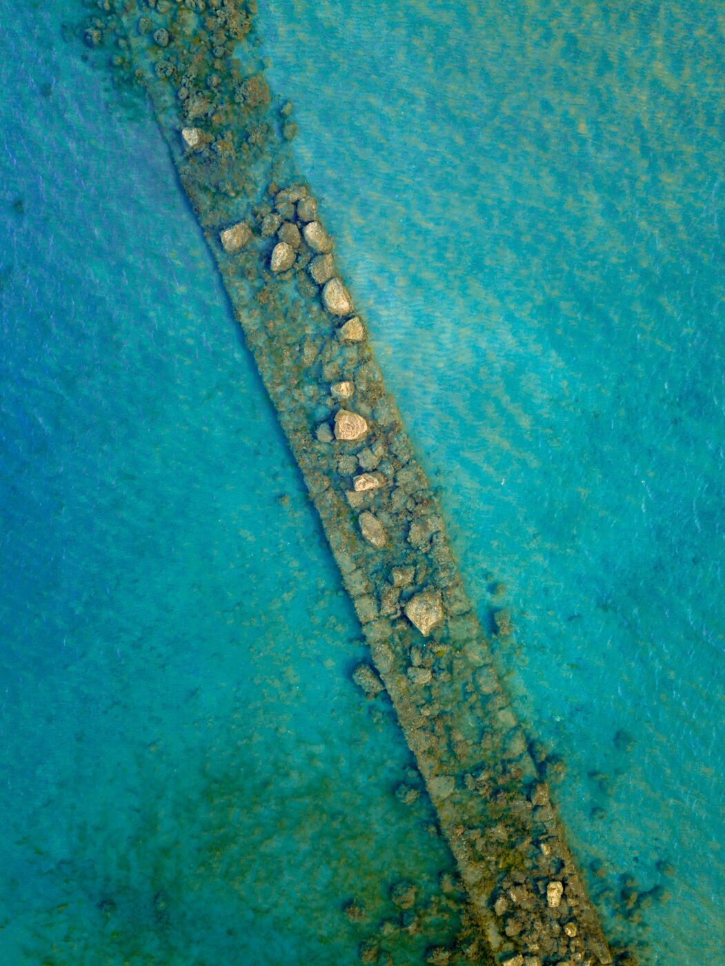
Një nga katër qendrat e lashta të gjirit të Vlorës, e fortifikuar që në shekullin VI p.e.s. Në fund të shekullit IV p.e.s. muret rrethonin rreth 30 ha, duke e renditur Treportin mes qyteteve të mëdha të Ilirisë; konsiderohet vendndodhja e Aulonës së hershme. Gjatë zbaticës, muri jugor, 850 m i gjatë, del mbi sipërfaqen e detit.
One of the four ancient centres of the Bay of Vlorë, fortified from the 6th century BC. By the late 4th century BC its walls enclosed some 30 ha, ranking Treport among the large cities of Illyria; it is considered the site of early Aulona. At low tide, the 850 m southern wall rises above the sea.
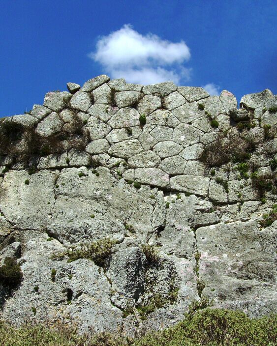
Olympe – Kalaja e MavrovësOlympe – Mavrovë Castle
Në majë të kodrës së fshatit Mavrovë janë gjetur gjurmët e qytetit antik Olympe, emri i të cilit shfaqet në monedha dhe në një tullë të vulosur. Aty janë zbuluar monedha bronzi të Lidhjes Epirote dhe të vetë qytetit, si dhe një mbishkrim kushtuar Zeusit. Jeta e qytetit u shua pas fushatës romake të vitit 167 p.e.s.
On the hilltop above the village of Mavrovë lie the remains of the ancient city of Olympe, whose name appears on coins and a stamped brick. Bronze coins of the Epirote League and of the city itself have been found, together with a dedication to Zeus. Life there faded after the Roman campaign of 167 BC.
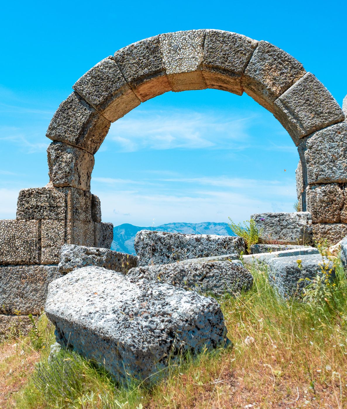
Qyteti ilir i AmantiasThe Illyrian city of Amantia
Qytet ilir i përmendur që në shekullin VI p.e.s., i rrethuar nga mure me perimetër 2.200 m. Ruhen porta harkore, tempulli dorik i Afërditës dhe stadiumi i shekullit III p.e.s., me shkallare ku janë gdhendur emra njerëzish. Në shekullin IV Amantia ishte seli peshkopale.
An Illyrian city recorded from the 6th century BC, enclosed by walls 2,200 m in circumference. Its arched gates, the Doric temple of Aphrodite and the 3rd-century BC stadium, with names carved into its stone seats, survive. By the 4th century AD Amantia was a bishopric.
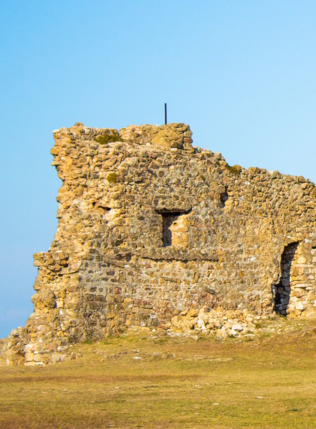
Kalaja e KaninësKanina Castle
Rreth 3 km në juglindje të Vlorës, kalaja kontrollonte gjithë gjirin. Ishte dalja në det e Amantias që në shekullin IV p.e.s., e më pas qendër ushtarake, kishtare dhe administrative e zonës deri në pushtimin osman. Brenda mureve (3,6 ha) janë gjetur nëntë porta dhe tri puse; aty sunduan Manfredi i Sicilisë, Muzakajt dhe Balshajt, deri te Rugina Balsha më 1417.
Some 3 km south-east of Vlorë, the castle commanded the whole bay. It served as Amantia’s outlet to the sea from the 4th century BC and later as the military, ecclesiastical and administrative centre of the area until the Ottoman conquest. Within its 3.6 ha of walls are nine gates and three wells; Manfred of Sicily, the Muzakas and the Balshas ruled here, until Rugina Balsha in 1417.
Orikum dhe TragjasOrikum and Tragjas
Në rrëzë të Karaburunit, 15 km nga Vlora, Orikumi ka të vetmen marinë të Shqipërisë dhe një nga parqet arkeologjike më interesante të bregdetit. Pranë tij, Tragjasi i Vjetër dhe kalaja e Gjon Boçarit ruajnë kujtesën e shekujve të fundit.
At the foot of Karaburun, 15 km from Vlorë, Orikum has Albania’s only marina and one of the most interesting archaeological parks on the coast. Nearby, Old Tragjas and Gjon Boçari Castle preserve the memory of more recent centuries.
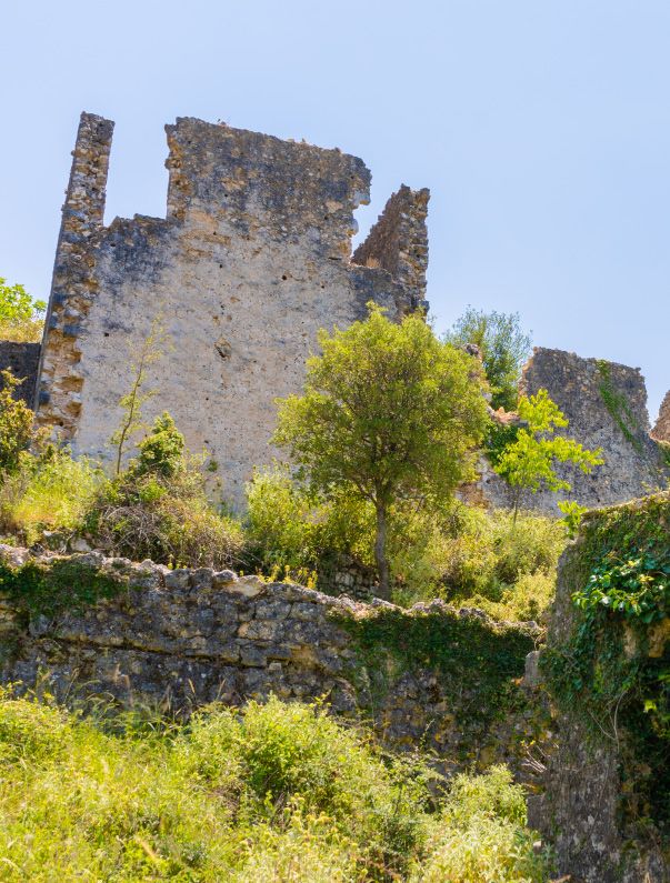
Tragjasi i VjetërOld Tragjas
Fshati në majë të kodrës u dogj tri herë gjatë Luftës së Dytë Botërore nga pushtuesit italianë dhe gjermanë. 300 shtëpitë prej guri, dykatëshe, qëndrojnë pa çati, me gjurmët e zjarrit ende në mure. Në qendër ruhen kroi dhe rrapi, ndërsa në majë një tyrbe osmane me yllin e Davidit të gdhendur.
The hilltop village was burned three times during the Second World War by Italian and German forces. Its 300 two-storey stone houses stand roofless, scorch marks still on the walls. The village fountain and plane tree survive at its centre, and at the top an Ottoman tomb carved with the Star of David.
Kalaja e Gjon BoçaritGjon Boçari Castle
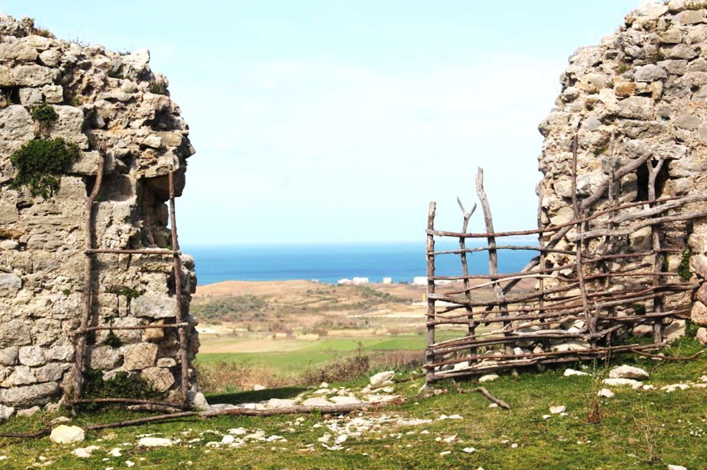
Fortesë katërkëndëshe 30 x 18 m pranë Tragjasit, me mure deri 4 m të larta, frëngji për armë zjarri dhe dy kulla poligonale. Një regjistër osman i fundit të shekullit XVII e përmend si “Gjoniqestra” dhe shënon se aty strehoheshin 61 familje hebreje të ardhura nga Vlora gjatë luftërave venedikase–osmane.
A 30 x 18 m quadrangular fort near Tragjas, with walls up to 4 m high, gun loops and two polygonal towers. A late-17th-century Ottoman register calls it “Gjoniqestra” and records 61 Jewish families sheltering there from Vlorë during the Venetian–Ottoman wars.
Qyteti antik i OrikutThe ancient city of Oricum
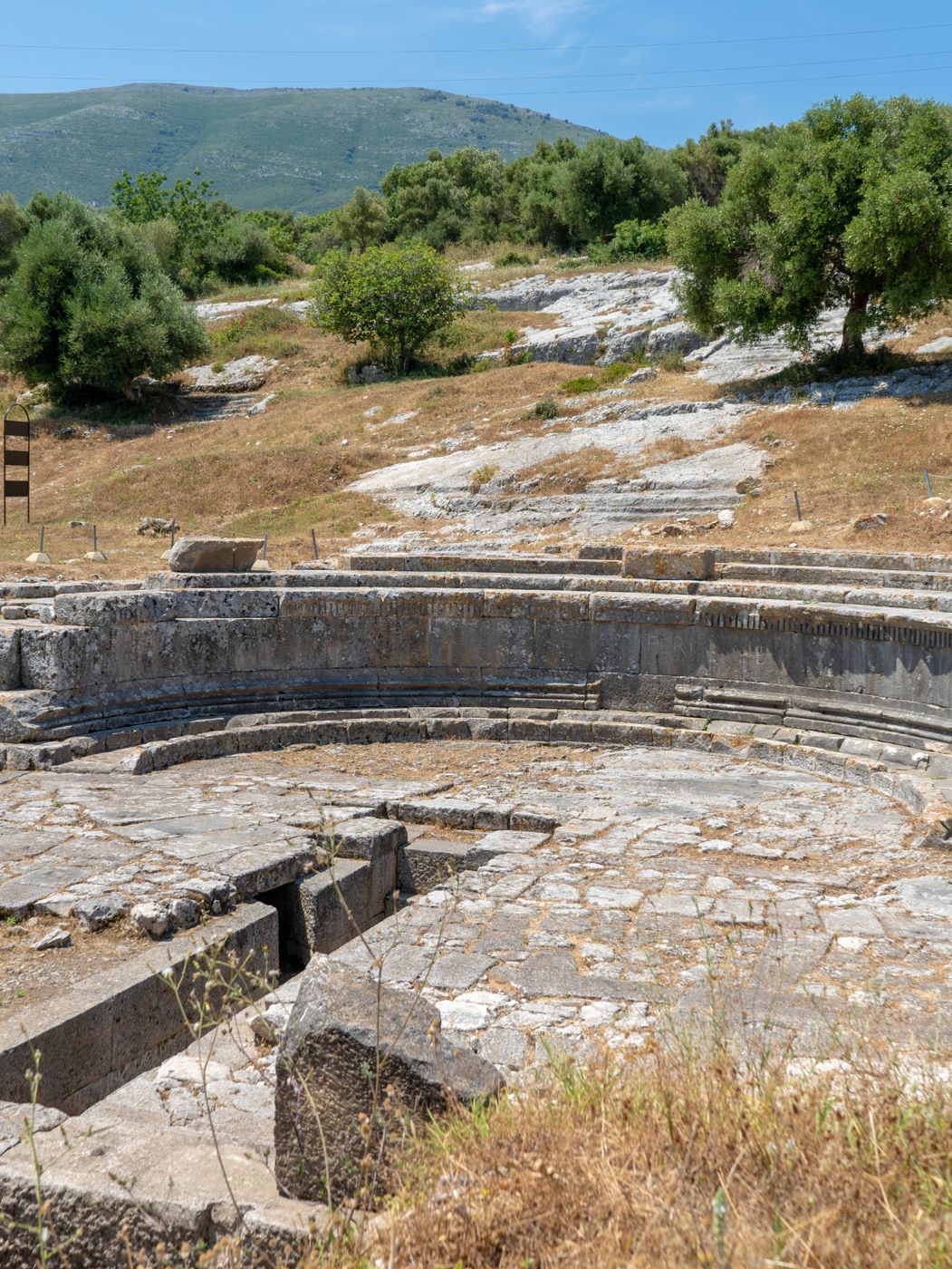
Mbi një kodër 32 m të lartë, mes detit dhe lagunës, Oriku hyri në histori më 49 p.e.s., kur u pushtua nga Jul Cezari gjatë luftës me Pompeun. Muri rrethues, 1.100 m i gjatë, mbron 7,8 ha. Monumenti më përfaqësues, i quajtur dikur teatër, sipas misionit shqiptaro-zviceran ka qenë një nimfe – rezervuar uji i kushtuar nimfave.
On a 32 m hill between the sea and the lagoon, Oricum entered history in 49 BC when Julius Caesar took it during his war with Pompey. Its 1,100 m circuit wall encloses 7.8 ha. Its signature monument, long thought to be a theatre, has been identified by the Albanian–Swiss mission as a nymphaeum – a water reservoir dedicated to the nymphs.
Kisha e MarmiroitMarmiroi Church
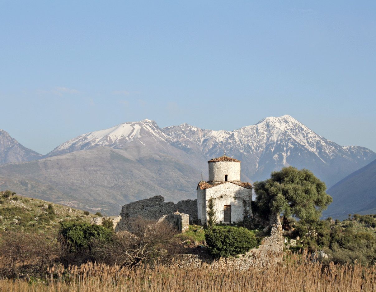
Rreth 3 km nga Orikumi, mbi një kodër pranë lagunës, ndodhet kisha e vogël e Shën Marisë, e përmendur në një krisobulë të vitit 1307. Ka planimetri në formë kryqi të lirë, me absidë gjysmërrethore dhe kupolë mbi katër pilastra. Studiuesit e datojnë në shekujt XII–XIII.
About 3 km from Orikum, on a hill above the lagoon, stands the small Church of St Mary, mentioned in a chrysobull of 1307. It is a free-cross church with a semicircular apse and a dome on four piers. Scholars date it to the 12th–13th centuries.
Gjiri i Gramës dhe mbishkrimetGrama Bay and its inscriptions
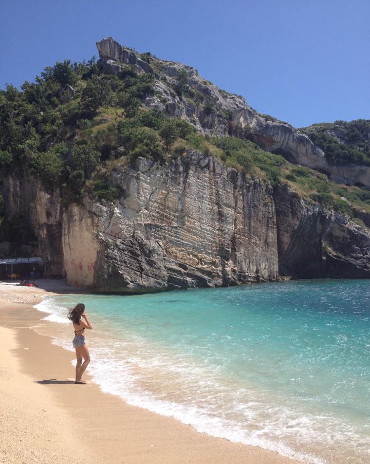
Gji i vogël me rërë në bregun shkëmbor të Karaburunit, i përdorur që në shekullin VI p.e.s. si gurore për Apoloninë dhe Durrësin. Në shkëmbinjtë e tij detarët që strehoheshin nga stuhitë kanë gdhendur qindra mbishkrime greke e latine – lutje për Dioskurët e më vonë për Krishtin. Arrihet vetëm nga deti.
A small sandy cove on the rocky Karaburun coast, quarried from the 6th century BC to supply Apollonia and Durrës. Sailors sheltering from storms carved hundreds of Greek and Latin inscriptions into its rocks – prayers to the Dioscuri and later to Christ. Reachable only by sea.
Dhërmi dhe VunoDhërmi and Vuno
Duke zbritur nga Qafa e Llogarasë, fshatrat e Rivierës ruajnë banesat dykatëshe prej guri, kishat bizantine dhe pamjen e menjëhershme mbi Detin Jon.
Descending from the Llogara Pass, the Riviera villages keep their two-storey stone houses, Byzantine churches and sweeping views over the Ionian Sea.
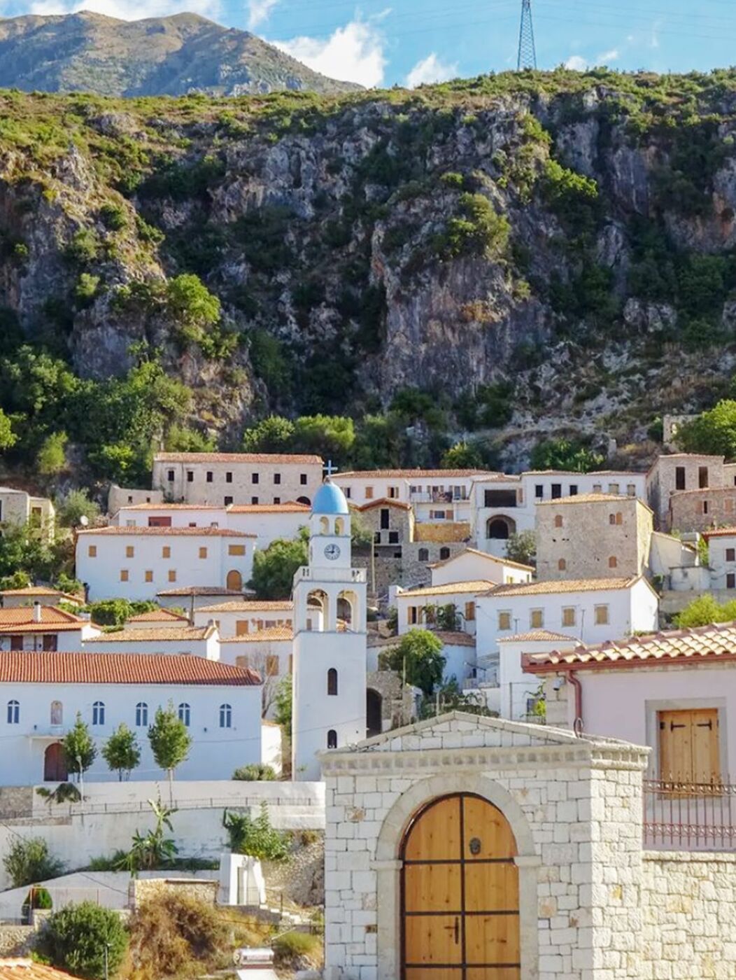
Dhërmiu: Manastiri i Pangjisë dhe kisha e Shën StefanitDhërmi: Panagia Monastery and St Stephen’s Church
Fshati i vjetër, i përmendur që në kohën e Cezarit, ruan shumë kisha. Në majë ngrihet Manastiri i Pangjisë (Shën Marisë), një nga shembujt më të hershëm të arkitekturës bizantine, me altar të shekullit X. Poshtë në fshat, kisha e Shën Stefanit (shek. XII–XIII) ka afreske ndër më të vjetrat në vend. Dhërmiu është vendlindja e shkrimtarit Petro Marko.
The old village, mentioned since Caesar’s time, has many churches. At the top stands the Panagia (St Mary) Monastery, one of the earliest examples of Byzantine architecture, with a 10th-century altar. Lower down, St Stephen’s Church (12th–13th c.) holds some of the oldest frescoes in the country. Dhërmi is the birthplace of the writer Petro Marko.
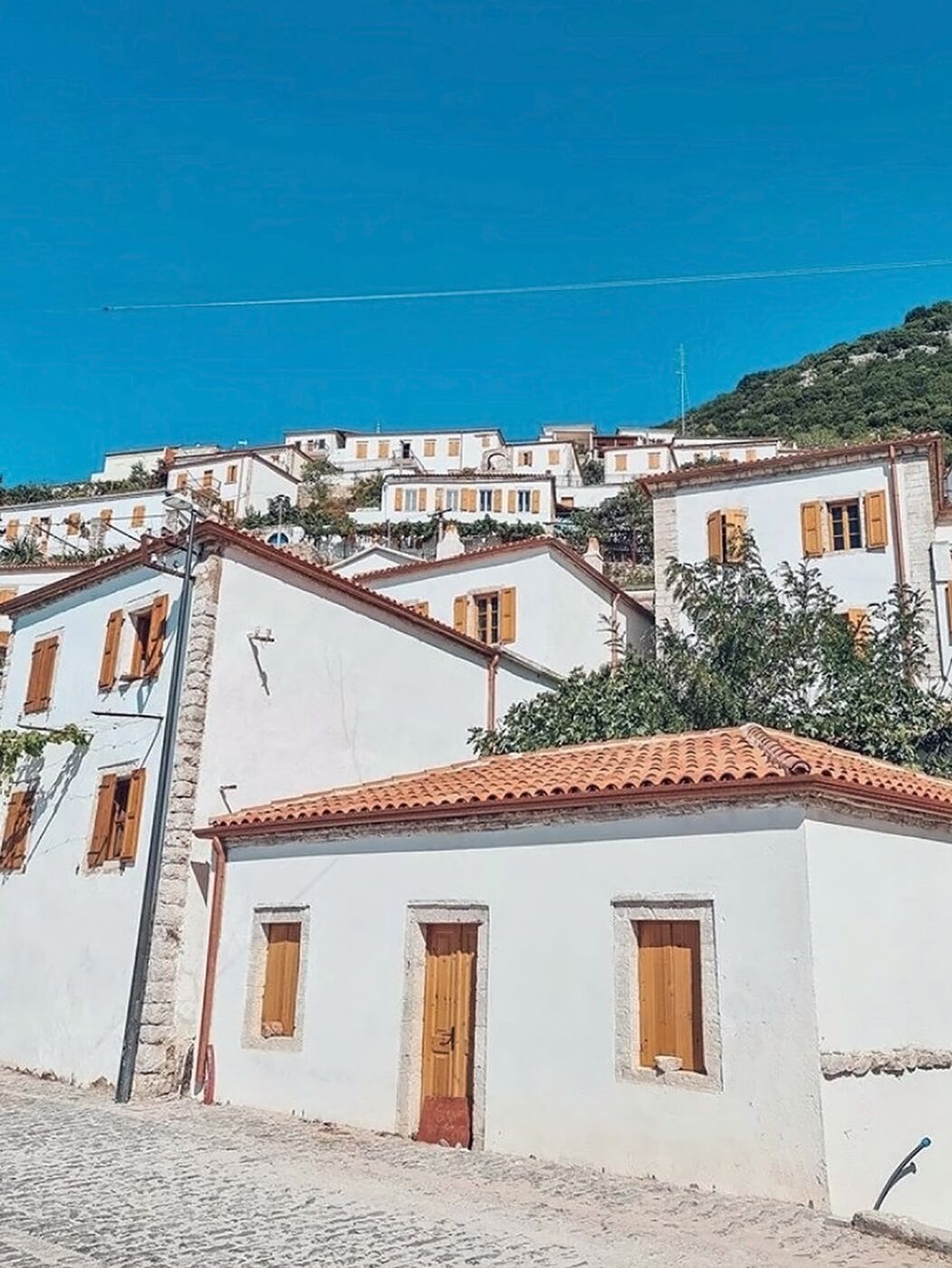
Vuno dhe kanioni i GjipesëVuno and Gjipe Canyon
Fshat mesjetar me shtëpi guri të renditura si amfiteatër mbi ullishte shekullore, ku ndaluan Lord Bajroni dhe Edward Lear. Ruhen kishat e Shën Spiridonit, Shën Mëhillit, Shën Mërisë së Mesodhisë dhe Shën Sotirës. Nga këtu nis kanioni i Gjipesë, 800 m i gjatë, që zbret deri te plazhi i Gjipesë.
A medieval village of stone houses rising like an amphitheatre above centuries-old olive groves, where Lord Byron and Edward Lear once stopped. Its churches include St Spyridon, St Michael, St Mary of Mesodhia and St Sotira. From here the 800 m Gjipe Canyon leads down to Gjipe beach.
Himarë dhe Porto PalermoHimarë and Porto Palermo
Himara ndërthur detin e kaltër me një histori të gjatë: qyteti i vjetër mbi plazh, kalaja e lashtë, kishat dhe gjiri i Porto Palermos me kështjellën e Ali Pashës.
Himarë combines a blue sea with a long history: the old town above the beach, the ancient castle, its churches and the bay of Porto Palermo with Ali Pasha’s fortress.
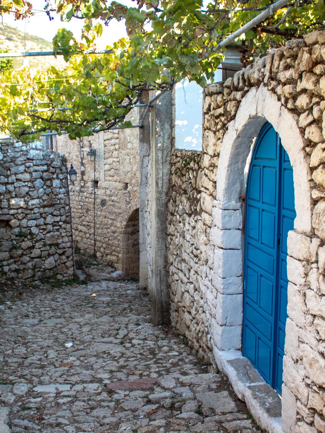
Kalaja dhe qyteti i vjetër i HimarësHimarë Castle and Old Town
Mbi 140 m lartësi, kalaja e Himarës përmendet nga Plini në shekullin I; muret e para i përkasin shekullit VIII p.e.s. Më 1480 u bë qendra e kryengritjes së madhe ku u vu në krye Gjon Kastrioti, i biri i Skënderbeut. Në shekujt XVI–XVII himarjotët, që e quanin veten “bijtë e mbretit Skënderbe”, u shkruanin Papëve e mbretërve të Napolit e Spanjës.
Rising 140 m above sea level, Himarë Castle is mentioned by Pliny in the 1st century AD; its earliest walls date to the 8th century BC. In 1480 it became the centre of a great uprising led by Gjon Kastrioti, son of Skanderbeg. In the 16th–17th centuries the Himariots, calling themselves “sons of King Skanderbeg”, wrote to the Popes and the kings of Naples and Spain.
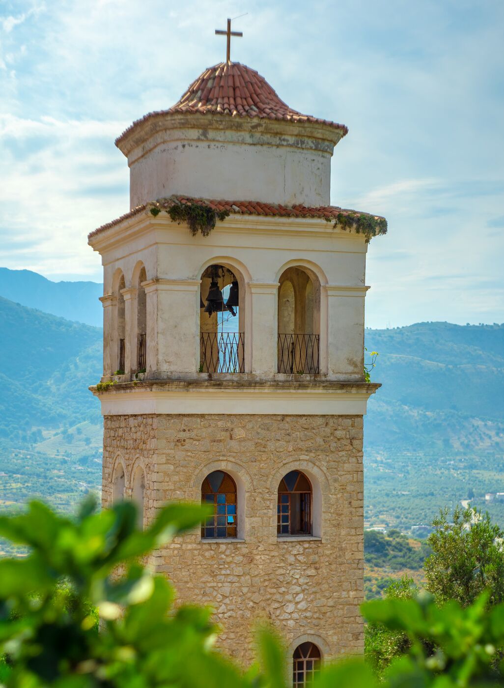
Kishat e kalasë së HimarësThe churches of Himarë Castle
Kisha katedrale e Shën Sergjit dhe Bakut i dha Himarës edhe emrin Sergjiopol; mbi portën e saj ruhet shqiponja dykrenore me kurorë, stema e Kastriotëve. Në hyrje të kalasë ngrihet kisha e Të Gjithë Shenjtorëve (shek. XVIII) me kambanoren e saj, në veri kisha e Shën Mëhillit dhe jashtë mureve kisha e Shën Mërisë.
The cathedral of Saints Sergius and Bacchus gave Himarë the name Sergiopolis; the crowned double-headed eagle of the Kastrioti family is still carved above its door. At the castle entrance stands the 18th-century Church of All Saints with its bell tower; St Michael’s lies to the north and St Mary’s outside the walls.
Kalaja e Porto PalermosPorto Palermo Castle
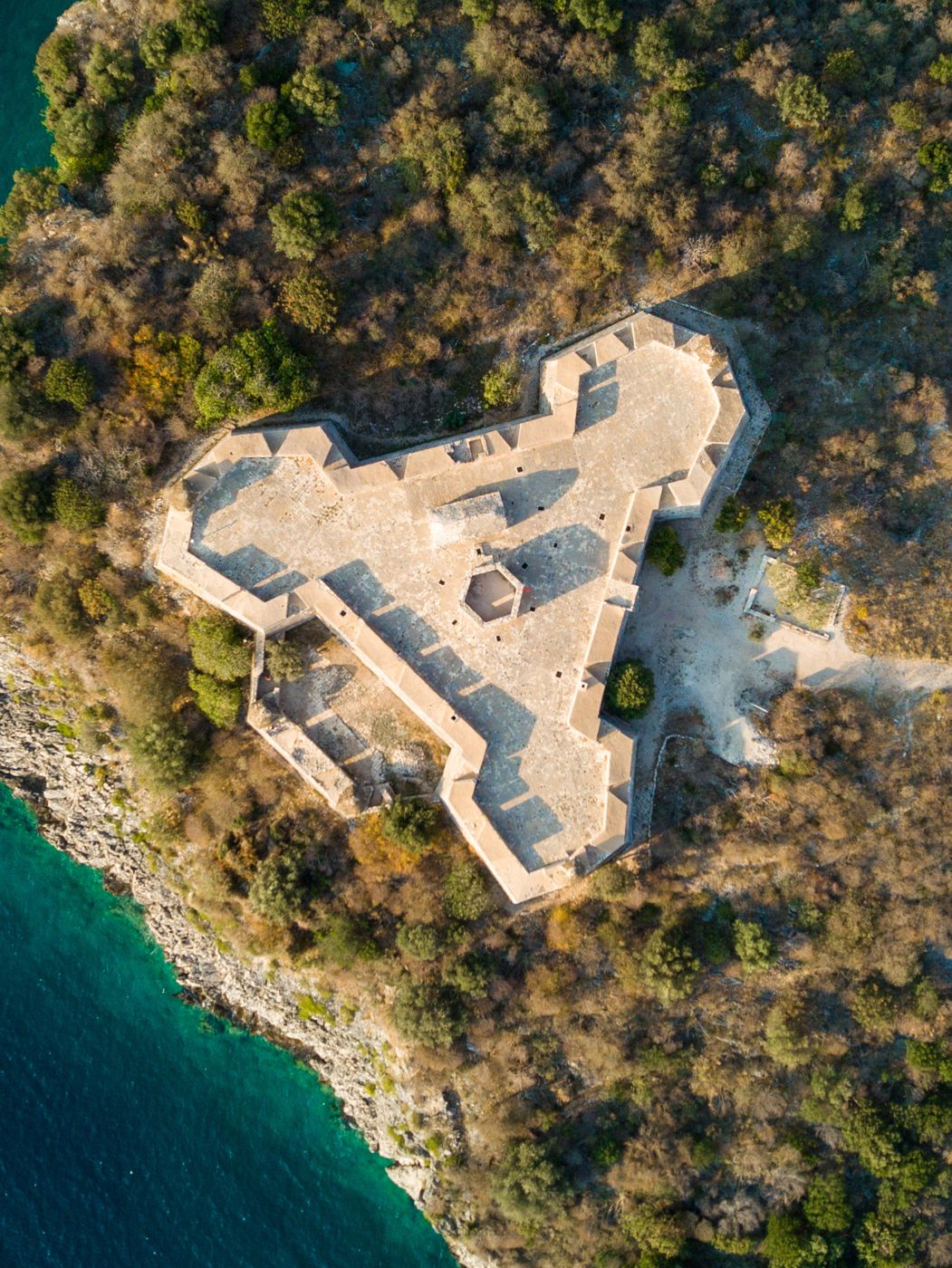
Kështjella trekëndëshe e Ali Pashë Tepelenës, e fundit të shekullit XVIII, me brinjë 60 m, mure deri 17 m të larta dhe tri kulla në kënde. U ndërtua për të mbrojtur portin dhe për të kontrolluar Himarën; më 1803 Ali Pasha ua ofroi anglezëve. Gjatë Luftës së Ftohtë gjiri ishte bazë e fshehtë detare, me tunel për nëndetëset.
Ali Pasha Tepelena’s triangular fortress of the late 18th century, with 60 m sides, walls up to 17 m high and three corner towers. It was built to guard the harbour and control Himarë; in 1803 Ali Pasha offered it to the Royal Navy. During the Cold War the bay was a secret naval base, with a tunnel for submarines.
Qeparo dhe BorshQeparo and Borsh
Fshatrat mbi shkëmbinj dhe ullishtet e pafundme të Borshit ruajnë një nga kalatë më të rëndësishme të Labërisë bregdetare.
Clifftop villages and the endless olive groves of Borsh guard one of the key castles of coastal Labëria.
Qeparoi i VjetërOld Qeparo
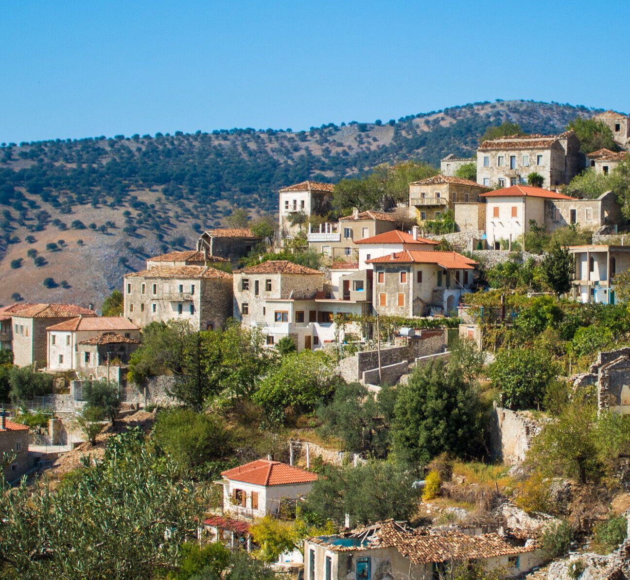
Fshati i vjetër, i mbështetur në një majë të lartë dhe i rrethuar nga humnera në tri anë, është si një kështjellë natyrore. Shtëpitë e larta prej guri ngjajnë me kulla. Emri lidhet me qiparisat e shumtë të zonës, ndërsa plazhi poshtë ka rërë të imët dhe ujë të cekët.
Perched on a high peak and bounded by cliffs on three sides, the old village is a natural fortress. Its tall stone houses resemble towers. The name is said to come from the area’s many cypresses, while the beach below has fine sand and shallow water.
Kalaja e Sopotit, BorshSopot Castle, Borsh
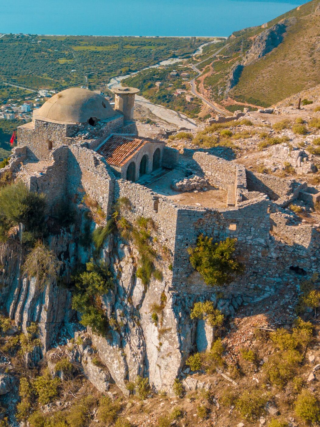
Mbi një kodër shkëmbore 2 km nga deti, kalaja ka zanafillë antike (shek. IV p.e.s.) dhe u bë strategjike në periudhën bizantine. Kaloi te Despotati i Epirit, te Manfredi i Sicilisë, te Balsha II dhe pas 1417 te osmanët, të cilët e përdorën për të mbajtur nën kontroll Labërinë dhe Himarën. Brenda ruhen xhamia e Haxhi Bedos, sterna dhe një varr monumental antik.
On a rocky hill 2 km from the sea, the castle has ancient origins (4th c. BC) and became strategic in Byzantine times. It passed to the Despotate of Epirus, to Manfred of Sicily, to Balsha II and after 1417 to the Ottomans, who used it to hold Labëria and Himarë. Inside are the Haxhi Bedo mosque, cisterns and an ancient monumental tomb.
Sarandë (Onhezmi)Sarandë (Onchesmos)
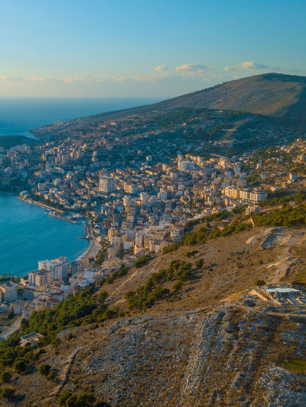
Saranda, Onhezmi i lashtë, është porta e jugut të qarkut: qytet bregdetar me monumente të antikitetit të vonë dhe pikënisje për Ksamilin, Butrintin dhe Syrin e Kaltër.
Sarandë, ancient Onchesmos, is the gateway to the south of the region: a seaside city with Late Antique monuments and a base for Ksamil, Butrint and the Blue Eye.
Qyteti i SarandësThe city of Sarandë
Me plazhet e veta dhe ato përreth – Plazhi i Manastirit, Pasqyrat, Pulëbardha dhe ishujt e Ksamilit – Saranda është vendi ideal për të eksploruar Rivierën. Emri vjen nga Manastiri i Dyzet Shenjtorëve (“saranda” = dyzet në greqisht).
With its own beaches and those nearby – Monastery Beach, Mirror Beach, Seagull Beach and the islands of Ksamil – Sarandë is an ideal base for exploring the Riviera. Its name comes from the Monastery of the Forty Saints (“saranda” means forty in Greek).
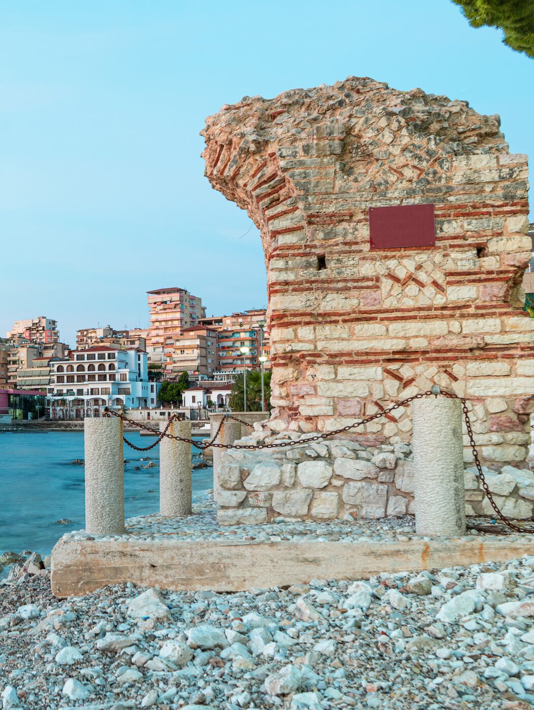
Kalaja e OnhezmitOnchesmos Castle
Onhezmi, porti natyror i Foinikes, përmendet ndër 12 qytetet e Epirit të Vjetër dhe si seli peshkopale më 415. Muret e kalasë, 850 m të gjata, 2,5 m të gjera dhe deri 6,5 m të larta, rrethonin 5 ha; pjesë të tyre dhe kullat duken ende në qendër të qytetit. Jeta u ndërpre në fund të shekullit VI.
Onchesmos, the natural harbour of Phoenice, is listed among the 12 cities of Old Epirus and as a bishopric in 415. Its walls – 850 m long, 2.5 m thick and up to 6.5 m high – enclosed 5 ha; sections and towers can still be seen in the city centre. Life ended in the late 6th century.
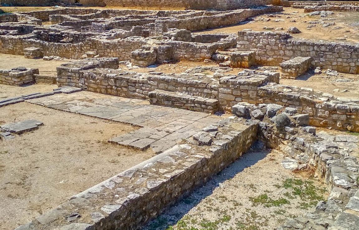
Sinagoga dhe bazilika e SarandësSynagogue and basilica of Sarandë
Në qendër të qytetit, një vilë romake e shekujve II–III u shndërrua në shekujt IV–VI në sinagogë, një nga më të rrallat në Ballkan. Mozaiku me menorën shtatëkrahëshe dëshmon praninë e komunitetit hebre. Në fund të shekullit VI u kthye në bazilikë paleokristiane. U zbulua nga një mision i përbashkët shqiptaro-izraelit.
In the city centre, a 2nd–3rd-century Roman villa became a synagogue in the 4th–6th centuries – one of the rarest in the Balkans. A mosaic of the seven-branched menorah attests to its Jewish community. In the late 6th century it became an early Christian basilica. It was uncovered by a joint Albanian–Israeli mission.
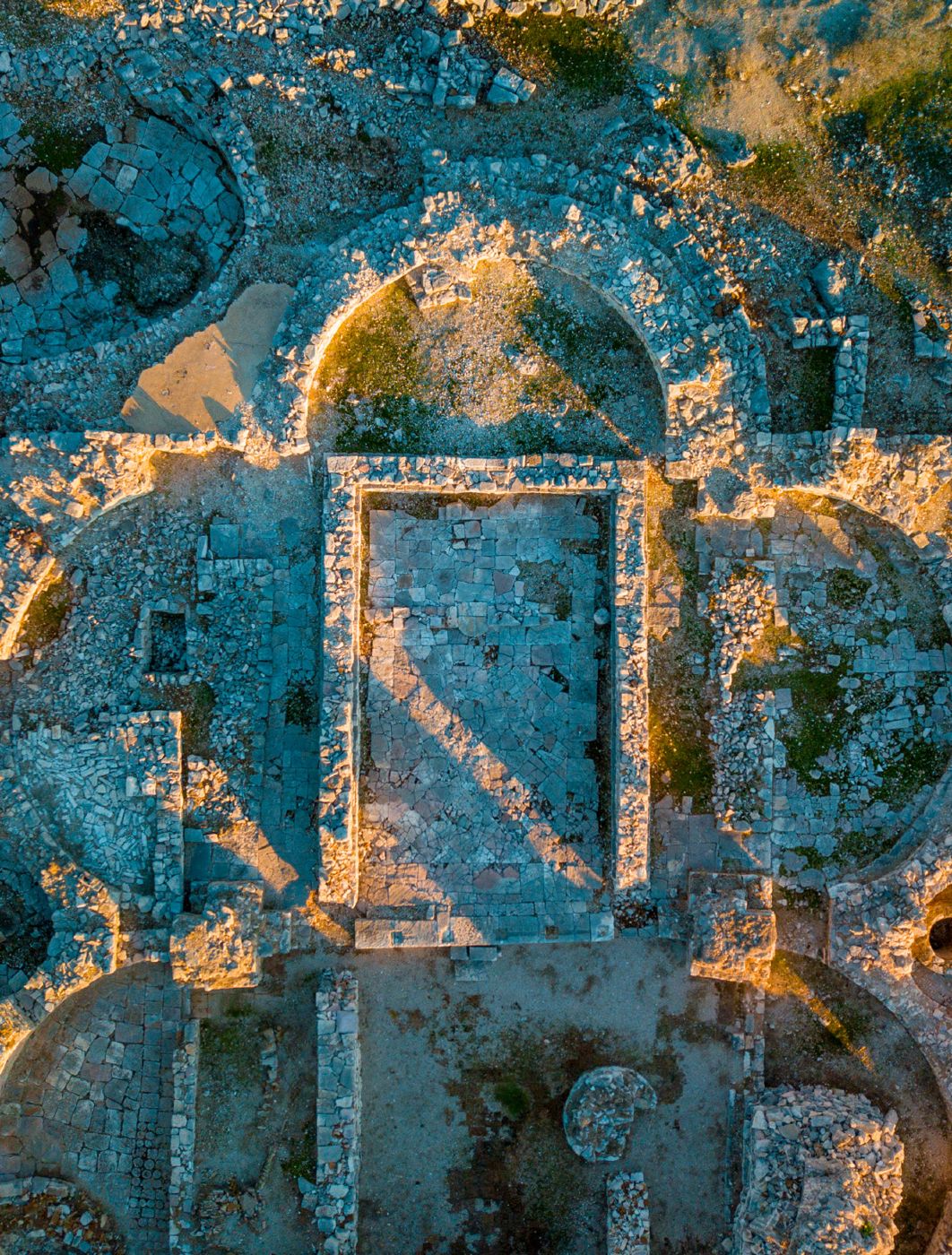
Manastiri i Dyzet ShenjtorëveMonastery of the Forty Saints
Mbi një kodër 211 m, manastiri kushtuar Dyzet Martirëve të Sebastes i dha qytetit emrin. Kisha, bazilikë me shtatë absida 43 x 23 m, është ndër kishat më të mëdha paleokristiane të Ballkanit. Kripta ruan piktura murale të shekujve VI dhe IX. U dëmtua më 1878 dhe përsëri gjatë Luftës së Dytë Botërore.
On a 211 m hill, the monastery dedicated to the Forty Martyrs of Sebaste gave the city its name. Its church, a seven-apsed basilica of 43 x 23 m, is among the largest early Christian churches in the Balkans. The crypt preserves wall paintings of the 6th and 9th centuries. It was damaged in 1878 and again in the Second World War.
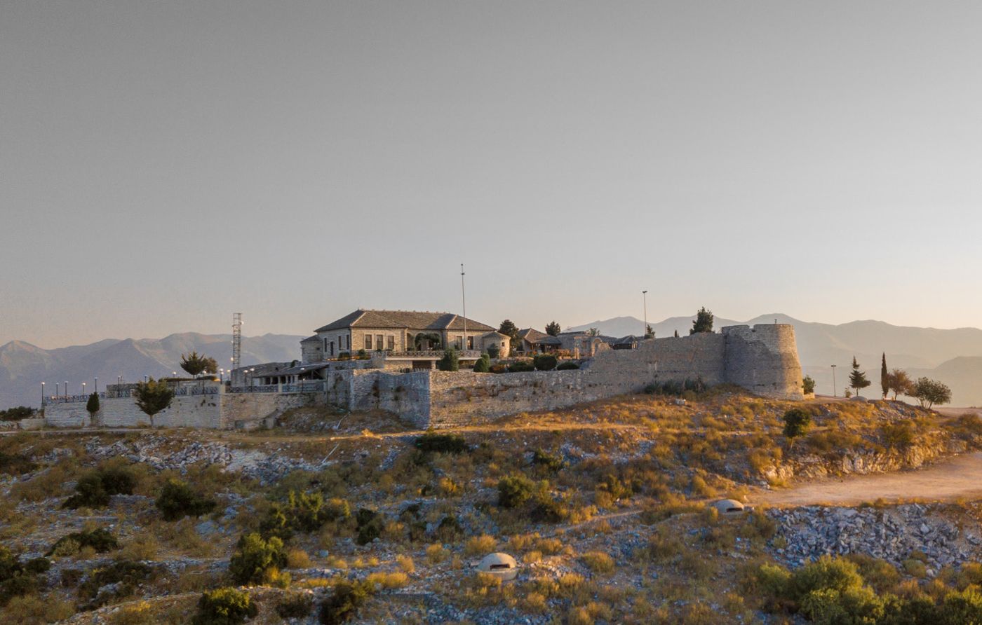
Kalaja e LëkurësitLëkurësi Castle
E ndërtuar nga Sulejmani i Madhërishëm më 1537 për të kontrolluar Sarandën, kalaja ka plan pothuajse katror 42 x 44 m, me dy kulla rrethore dhe një drejtkëndëshe. Sot është restauruar si pikë turistike me restorant dhe pamje mbresëlënëse mbi qytet dhe Korfuz.
Built by Suleiman the Magnificent in 1537 to control Sarandë, the castle has an almost square 42 x 44 m plan with two round towers and one rectangular one. Today it has been restored as a visitor spot with a restaurant and stunning views over the city and Corfu.
Manastiri i Kakomesë dhe kisha e Shën Premtes, LukovëKakome Monastery and St Paraskevi’s Church, Lukovë
Rreth 10 km nga Saranda, pranë plazhit të Kakomesë, manastiri i shekullit XVIII ruan kishën e Shën Marisë (shek. XVI–XVII), me kupolë tetëfaqëshe dhe mure të larta mbrojtëse. Në pyllin mbi Lukovë fshihet kisha bazilikale e Shën Premtes (shek. XVII), kambana e së cilës u dhurua më 1695 nga mbreti i Napolit.
About 10 km from Sarandë, near Kakome beach, the 18th-century monastery shelters the Church of St Mary (16th–17th c.) with an eight-sided dome and high defensive walls. In the woods above Lukovë hides the 17th-century basilica of St Paraskevi, whose bell was donated by the King of Naples in 1695.
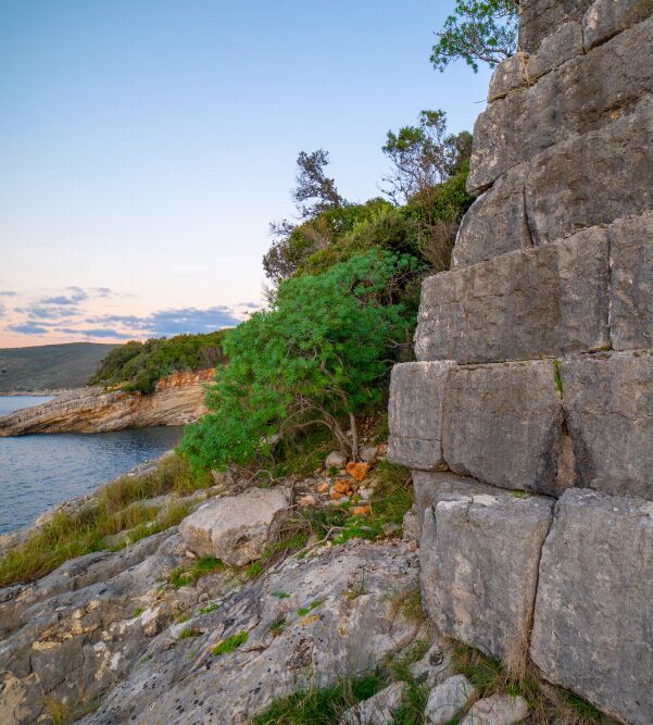
Muri i DemësThe Dema Wall
Në rrugën Sarandë–Ksamil, muri i shekullit V p.e.s. shtrihej nga deti deri te liqeni i Butrintit për të mbrojtur Butrintin. I gjatë 650 m dhe 7–9,6 m i gjerë, përbëhet nga dy mure paralele që lejonin vendosjen e armëve të rënda dhe lëvizjen e shpejtë të trupave. Venedikasit e rindërtuan më 1386.
On the Sarandë–Ksamil road, this 5th-century BC wall ran from the sea to Lake Butrint to shield Butrint. 650 m long and 7–9.6 m wide, it consists of two parallel walls that allowed heavy weapons to be positioned and troops to move quickly. The Venetians rebuilt it in 1386.
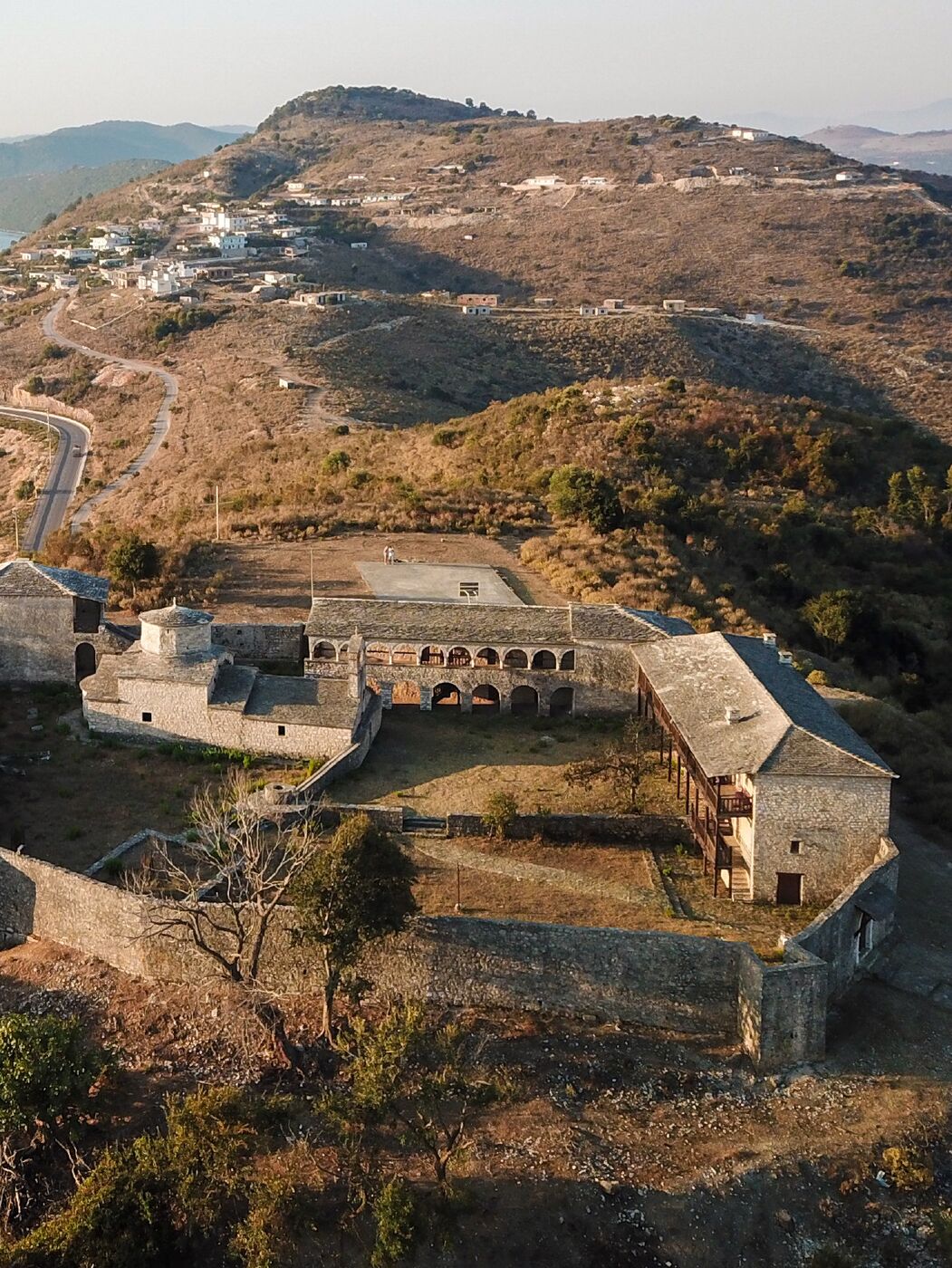
Manastiri i Shën GjergjitMonastery of St George
I ndërtuar në shekullin XVII mbi rrënojat e Murit të Demës, manastiri i fortifikuar ka pamje mahnitëse mbi Jonin në perëndim dhe liqenin e Butrintit në lindje. Kisha njënefëshe 20 x 10 m, me kupolë mbi tambur të lartë, ruan tri shtresa pikturash murale.
Built in the 17th century on the ruins of the Dema Wall, the fortified monastery overlooks the Ionian Sea to the west and Lake Butrint to the east. Its single-nave church (20 x 10 m), with a dome on a high drum, preserves three successive layers of wall paintings.
ButrintiButrint
Butrinti, sit i Trashëgimisë Botërore të UNESCO-s që nga viti 1992, është mozaik monumentesh që mbulon mbi dy mijë vjet histori – nga tempujt helenë dhe romakë te kështjellat venedikase dhe osmane.
Butrint, a UNESCO World Heritage Site since 1992, is a mosaic of monuments spanning more than two thousand years – from Greek and Roman temples to Venetian and Ottoman castles.
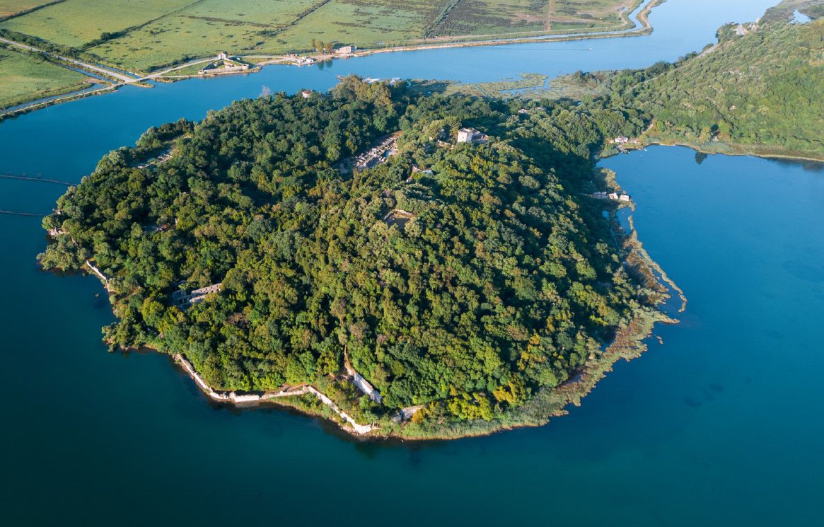
Qyteti antik i ButrintitThe ancient city of Butrint
I përmendur nga autorët antikë që në shekullin V p.e.s., Butrinti lulëzoi veçanërisht nën Romën. Porta e Luanit, Porta Skea, akropoli me muzeun dhe kulla venedikase e vitit 1560 dëshmojnë për fazat e tij. U shpall monument kulture më 1948 dhe ishte siti i parë arkeologjik i Shqipërisë në Listën e UNESCO-s.
Recorded by ancient authors from the 5th century BC, Butrint flourished above all under Rome. The Lion Gate, the Scaean Gate, the acropolis with its museum and the Venetian tower of 1560 trace its phases. Declared a cultural monument in 1948, it was Albania’s first archaeological site on the UNESCO list.
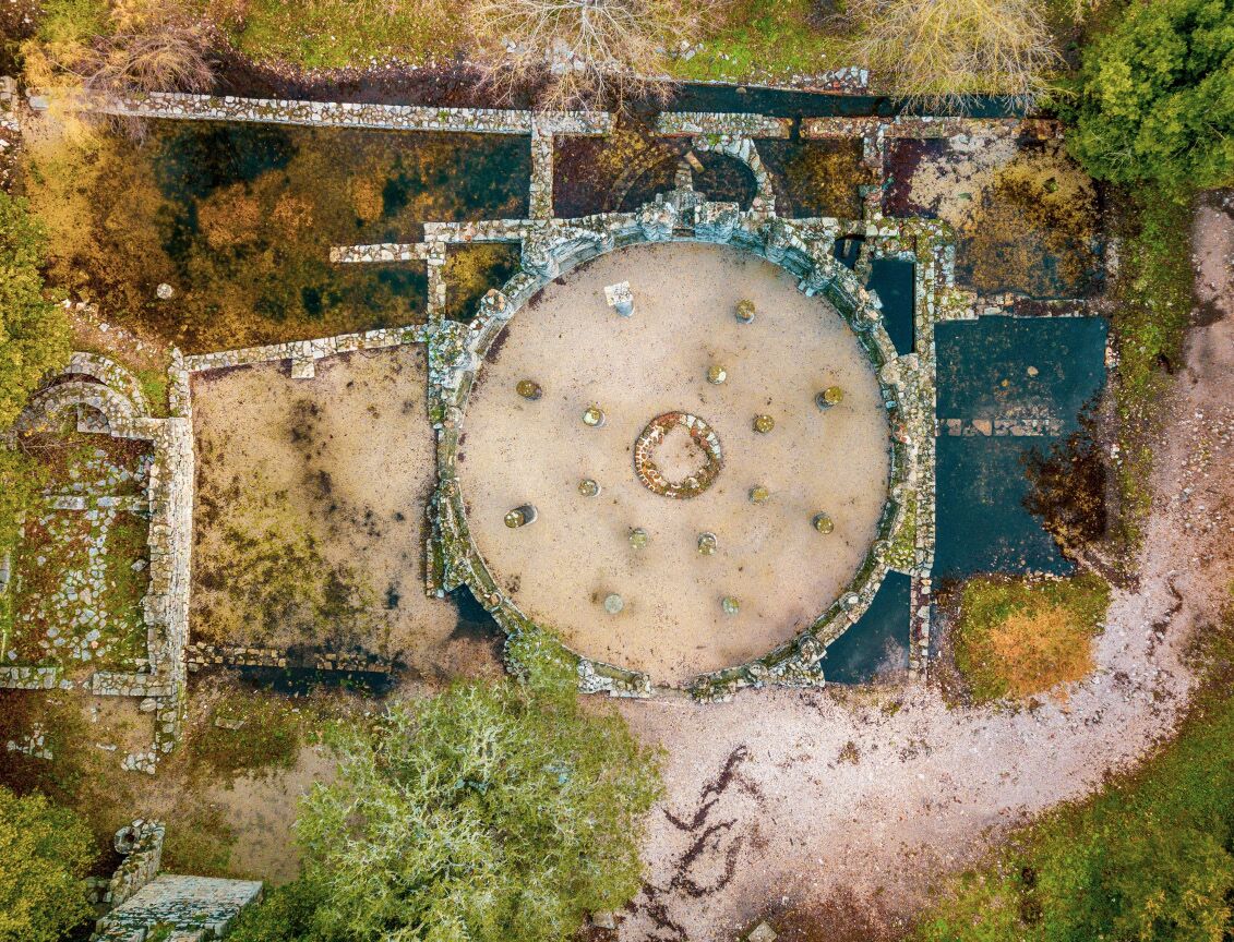
PagëzimorjaThe Baptistery
Monumenti kryesor i krishterimit të hershëm në Butrint, i shekullit V, me diametër 13,5 m – pagëzimorja rrethore më e madhe në Mesdhe. Dy unaza me nga tetë kolona graniti egjiptian mbanin kupolën. Dyshemeja e mozaikut, me shtatë unaza motivesh gjeometrike, kafshësh e zogjsh, përfaqëson Kopshtin e Edenit.
The principal early Christian monument of Butrint, dating to the 5th century, with a diameter of 13.5 m – the largest circular baptistery in the Mediterranean. Two rings of eight Egyptian granite columns carried the dome. Its mosaic floor, with seven bands of geometric motifs, animals and birds, represents the Garden of Eden.
Bazilika e MadheThe Great Basilica
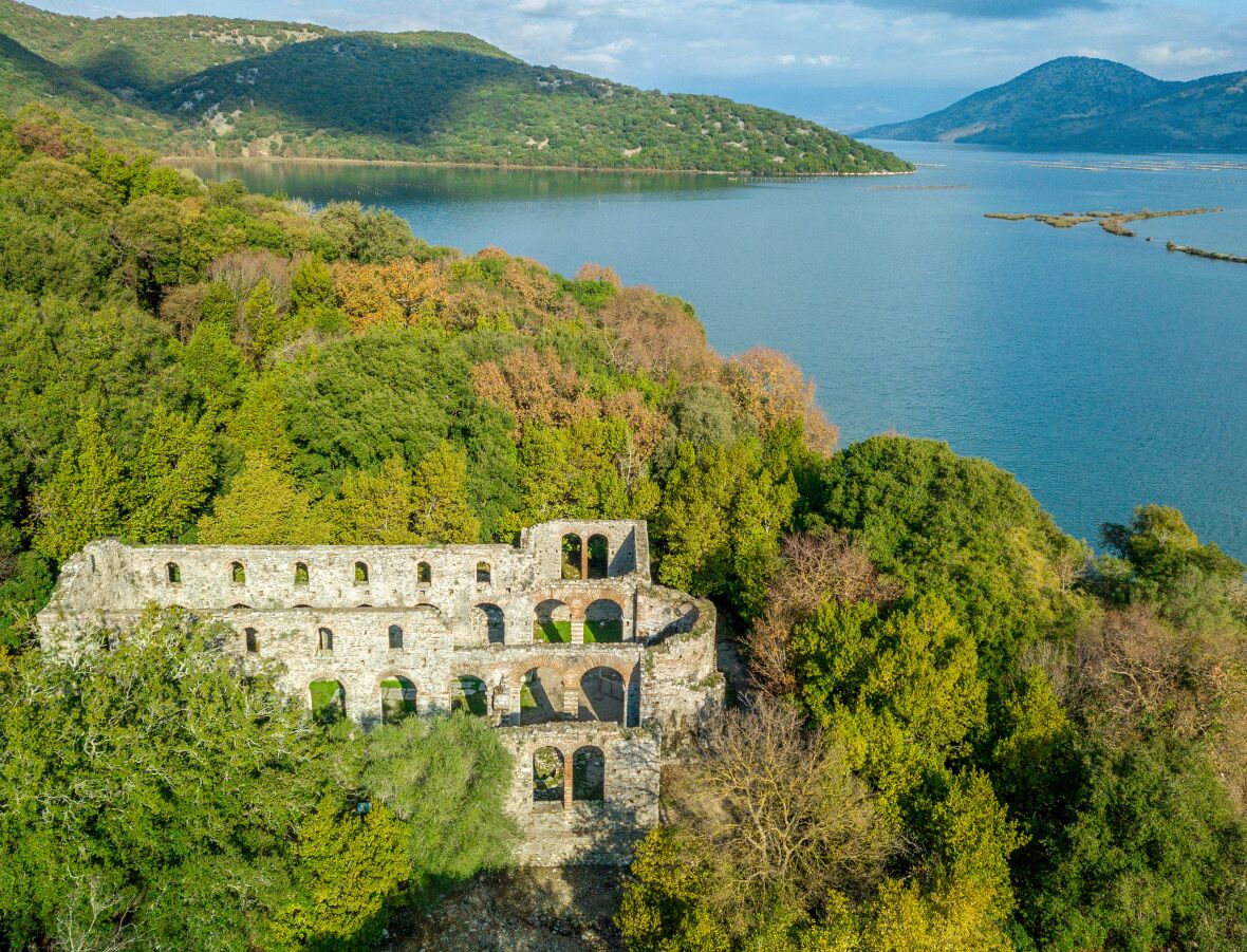
Kisha kryesore e antikitetit të vonë në Butrint (shek. VI), me plan në formë T-je, 24 x 32 m. Muret ruajnë ende lartësinë origjinale. Nefi qendror, 7 m i gjerë, mbaron me hapësirën e altarit të shtruar me mozaik gjeometrik.
The main Late Antique church of Butrint (6th c.), with a T-shaped plan of 24 x 32 m. Its walls still stand to their original height. The 7 m central nave ends in an altar area paved with geometric mosaic.
TeatriThe Theatre
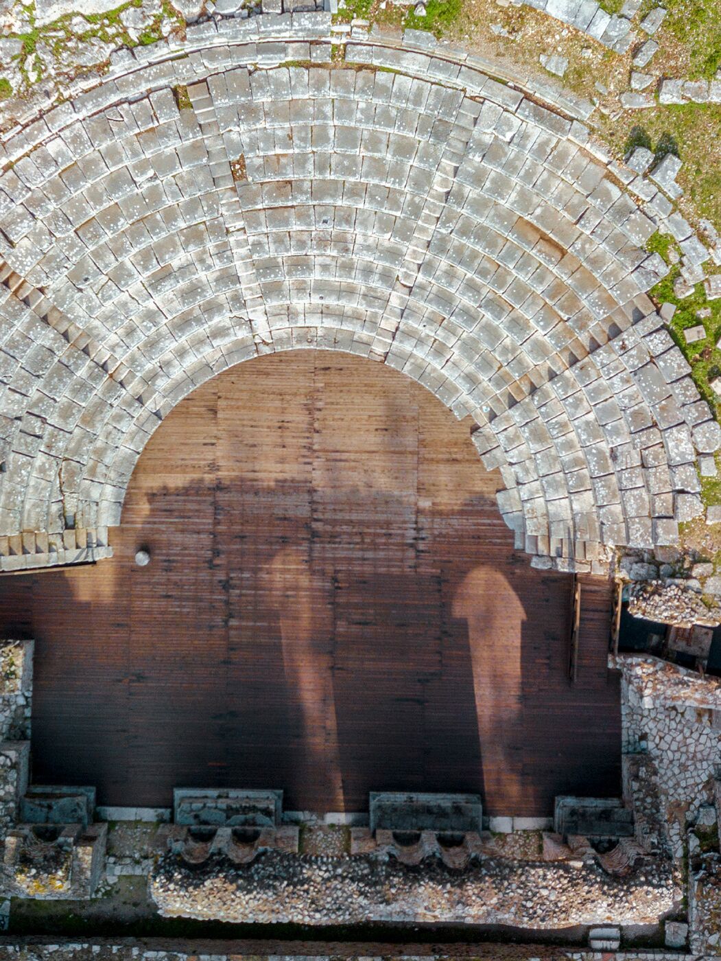
I ndërtuar në shekullin III p.e.s. në shpatin jugor të akropolit dhe i zbuluar nga Luigi Maria Ugolini më 1928–1930, kishte kapacitet rreth 1.700–2.000 spektatorë. Ndenjëset e nderit janë zbukuruar me putra pantere, kafsha e Dionisit. Në periudhën romake skena u rindërtua si ndërtesë dykatëshe e veshur me mermer.
Built in the 3rd century BC on the southern slope of the acropolis and uncovered by Luigi Maria Ugolini in 1928–1930, it held around 1,700–2,000 spectators. The seats of honour are decorated with panther paws, the animal of Dionysus. In Roman times the stage was rebuilt as a two-storey, marble-clad building.
Stoa kuruese dhe banjat romakeThe Healing Stoa and Roman Baths
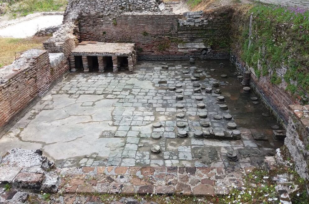
Stoa e shekullit V p.e.s., pranë tempullit të Asklepit, ishte vendi ku të sëmurët flinin duke pritur shërimin nga perëndia; kjo e rendit Butrintin pranë qendrave të njohura kuruese si Kosi dhe Epidauri. Banjat romake, të rinovuara në shekullin II, kishin dhoma të ngrohta me hipokaust dhe dysheme me mozaik bardhezi.
The 5th-century BC stoa beside the temple of Asclepius was where the sick slept awaiting the god’s cure, placing Butrint alongside famous healing centres such as Kos and Epidaurus. The Roman baths, renovated in the 2nd century, had hypocaust-heated rooms and black-and-white mosaic floors.
Kalaja trekëndëshe e Ali PashësAli Pasha’s Triangular Castle
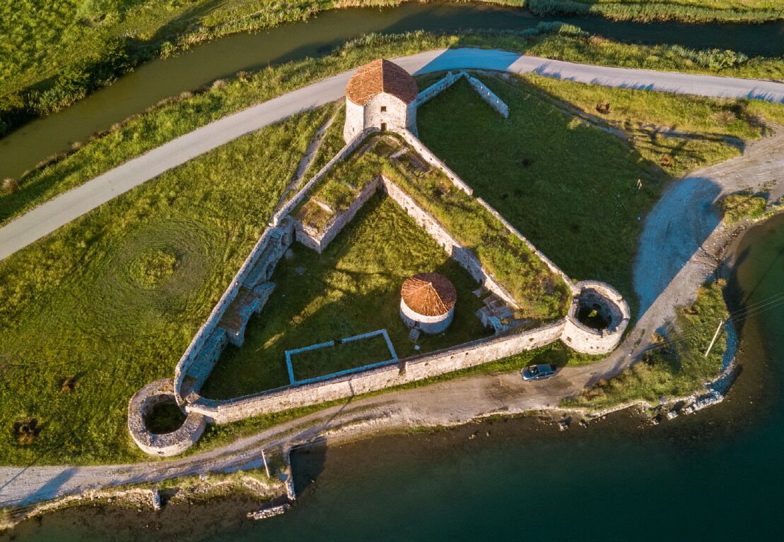
Në bregun përballë Butrintit, buzë kanalit të Vivarit, kalaja trekëndëshe me tri kulla rrethore u ngrit në fund të shekullit XIII dhe u forcua nga venedikasit dhe më pas në shekullin XVIII. Ishte mollë sherri mes ushtrisë franceze të Napoleonit dhe Ali Pashës: më 1797 francezët dogjën dy kulla dhe hodhën në erë të tretën.
On the bank opposite Butrint, beside the Vivari Channel, this triangular castle with three round towers was founded in the late 13th century and strengthened by the Venetians and again in the 18th century. It was disputed between Napoleon’s French army and Ali Pasha: in 1797 the French burned two towers and blew up the third.
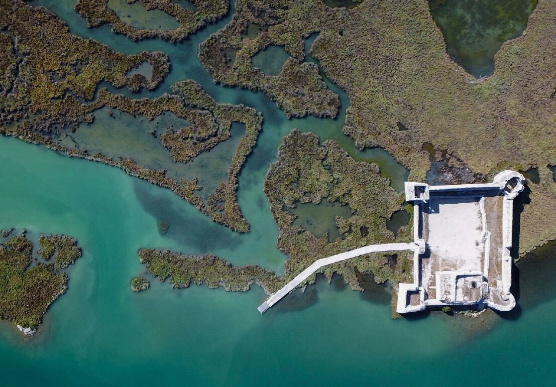
Kalaja e Ali Pashës në grykën e VivaritAli Pasha’s Castle at the Vivari estuary
E ndërtuar më 1807–1808 nga Ali Pashë Tepelena për t’u kundërvënë ushtrisë franceze të Korfuzit, kalaja 28 x 36 m ka katër kulla – dy rrethore nga deti dhe dy katrore nga kodra. E veçanta e saj është sistemi i brendshëm mbrojtës me frëngji, i projektuar për ta asgjësuar armikun edhe pasi të kishte shpërthyer portën.
Built in 1807–1808 by Ali Pasha Tepelena to counter the French army in Corfu, the 28 x 36 m castle has four towers – two round ones facing the sea and two square ones facing the hill. Its peculiarity is an internal defensive system of loopholes, designed to destroy the enemy even after the gate had been breached.
FiniqFiniq
Në luginën e Bistricës, Foinike ishte kryeqyteti i Kaonisë dhe një nga qendrat kryesore të Lidhjes Epirote.
In the Bistrica valley, Phoenice was the capital of Chaonia and one of the main centres of the Epirote League.
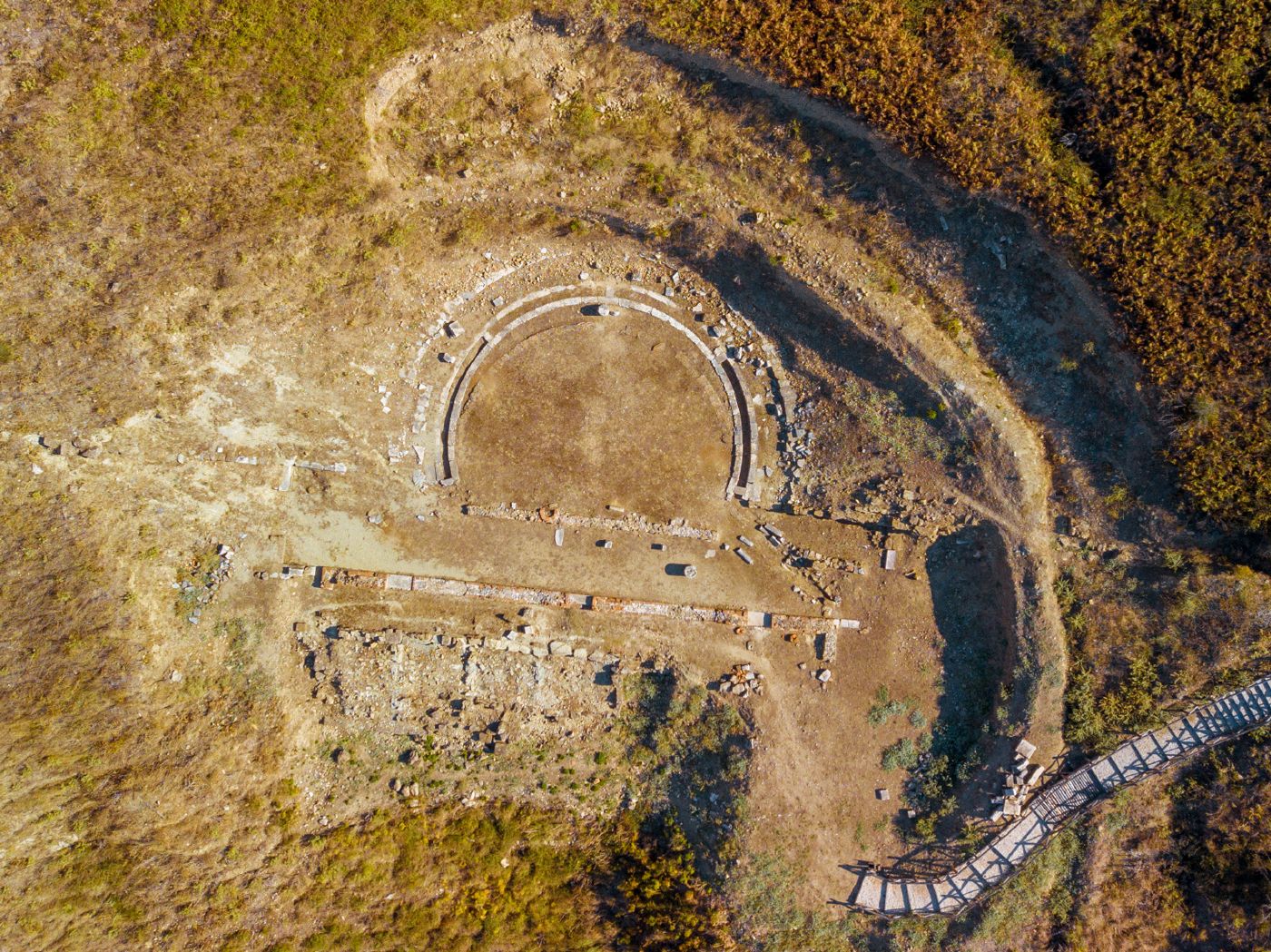
Qyteti antik i FoinikesThe ancient city of Phoenice
Kryeqytet i kaonëve në shekullin IV p.e.s. dhe qendër e Lidhjes Epirote nën Pirron, Foinike u quajt nga Polibi “qyteti më i madh dhe më i pasur i Epirit”. Këtu u nënshkrua më 205 p.e.s. paqja mes Filipit V të Maqedonisë dhe Romës. Ruhen muret 4.700 m, akropoli, agora, “Shtëpia me dy peristile”, teatri dhe nekropoli. Park arkeologjik kombëtar që nga viti 2005.
Capital of the Chaonians in the 4th century BC and a centre of the Epirote League under Pyrrhus, Phoenice was called by Polybius “the largest and richest city of Epirus”. Here in 205 BC peace was signed between Philip V of Macedon and Rome. Its 4,700 m walls, acropolis, agora, “House of the Two Peristyles”, theatre and necropolis survive. A national archaeological park since 2005.
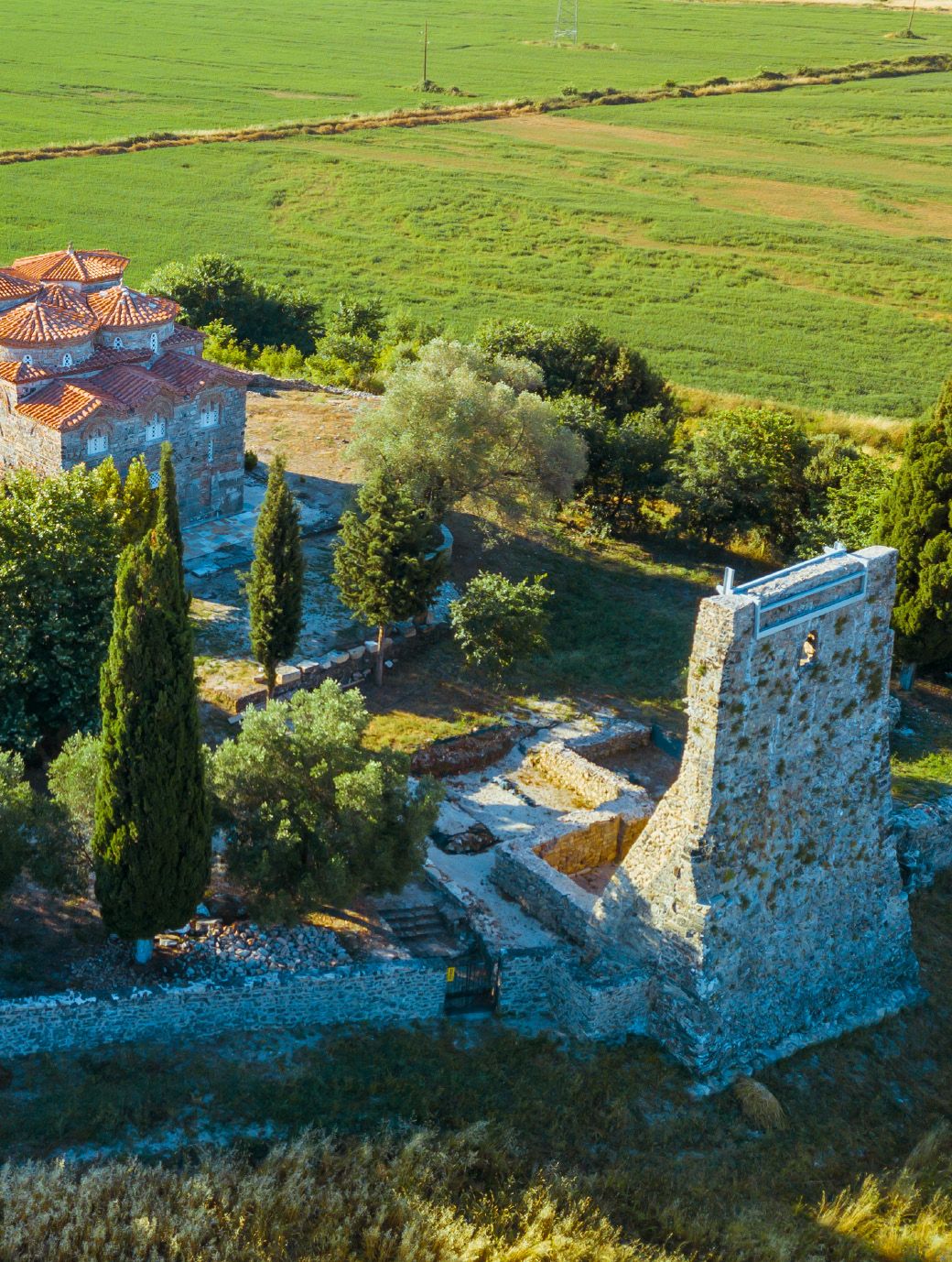
Manastiri i Shën Kollit, MesopotamSt Nicholas Monastery, Mesopotam
Manastir i fortifikuar që varej drejtpërdrejt nga Patriarkana e Kostandinopojës, me mure mbrojtëse 100 x 80 m. Kisha, me formë kubi 17,2 x 11 m dhe katër kupola, ka arkitekturë unike dhe është më e madhja ndër kishat bizantine të shekujve XI–XIV të ruajtura në Shqipëri. Mori formën e sotme në gjysmën e dytë të shekullit XIII.
A fortified monastery directly dependent on the Patriarchate of Constantinople, with defensive walls of 100 x 80 m. Its cube-shaped church (17.2 x 11 m) with four domes has a unique design and is the largest of the 11th–14th-century Byzantine churches preserved in Albania. It took its present form in the second half of the 13th century.
DelvinëDelvinë
Delvina, qendër sanxhaku në shekullin XVI, ruan kalanë mbi kurrizin shkëmbor, lagjet e vjetra dhe rrënojat e Kamenicës në shpatin e Malit të Gjerë.
Delvinë, seat of an Ottoman sanjak in the 16th century, preserves its castle on a rocky ridge, its old quarters and the ruins of Kamenica on the slopes of Mali i Gjerë.
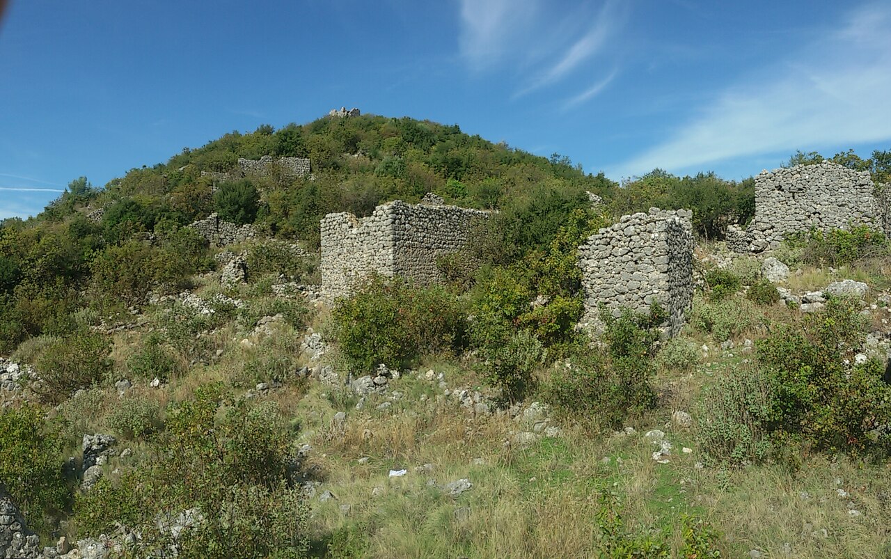
Rrënojat dhe kishat e KamenicësKamenica ruins and churches
Rreth 2 km në veri të Delvinës, fshati u braktis në shekullin XVII, ndoshta nga murtaja. Rrënojat e banesave, rrugicat dhe oborret kanë tiparet e një qyteti mesjetar-bizantin. Ruhen dy kisha të shekujve XIV–XV; njëra, në pjesën më të lartë, ka muret në lartësinë origjinale dhe absidë pesëfaqëshe me zbukurime tullash.
About 2 km north of Delvinë, the village was abandoned in the 17th century, probably because of plague. Its ruined houses, lanes and courtyards have the features of a medieval Byzantine town. Two 14th–15th-century churches survive; the upper one stands to its full height, with a five-sided apse decorated in brick.
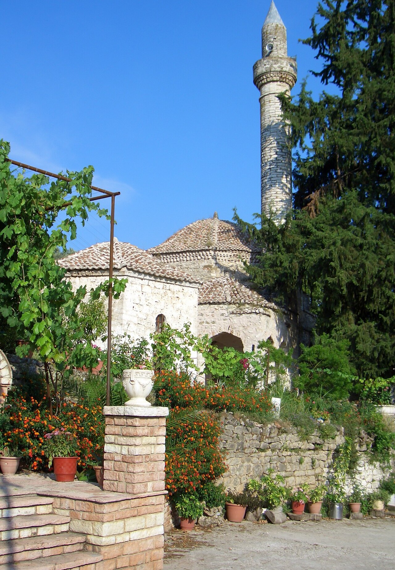
Xhamia e Gjin AleksitGjin Aleksi Mosque
Në lagjen Gjinaleks të Delvinës (sot Rusan), kisha e Shën Prodhromit u shndërrua në xhami më 1592, kur shumica e banorëve u konvertuan në islam. Dëshmi e rrallë e kalimit të një objekti kulti nga një besim në tjetrin; është në gjendje shumë të mirë.
In Delvinë’s Gjinaleks quarter (today Rusan), the Church of St Prodromos was converted into a mosque in 1592, when most of the population embraced Islam. A rare testimony of a sacred building passing from one faith to another, it is in very good condition.
Kalaja e DelvinësDelvinë Castle
E ngritur mbi një kurriz shkëmbor mes dy përrenjve, kalaja ka tri faza ndërtimi, më e rëndësishmja në shekullin XI, me tri kulla të formave të ndryshme. Evlija Çelebiu, që e vizitoi më 1670, shkruante se “nuk ka gjë të ngjashme me bukurinë e kalasë së Delvinës”.
Set on a rocky ridge between two streams, the castle has three building phases, the most important in the 11th century, each with three towers of different shapes. Evliya Çelebi, who visited in 1670, wrote that “there is nothing similar to the beauty of the castle of Delvinë”.
Burimi: “A beautiful journey in History and Nature – Vlorë–Thesprotia”, botim i projektit GET (GRALB Experience Tourism), Programi IPA II i Bashkëpunimit Ndërkufitar Greqi–Shqipëri 2014–2020. Botues: Instituti i Politikave Publike dhe Private (partner drejtues), Këshilli i Qarkut Vlorë, Dhoma e Thesprotisë dhe InnoPolis. Tekstet: Pëllumb Xhufi, Apollon Baçe. Fotografitë: Sokol Hila, Ergys Zhabiaku, përveç rasteve ku shënohet ndryshe. Përshkrimet në këtë faqe janë përmbledhje dhe përshtatje e Këshillit të Qarkut Vlorë. Ky botim është realizuar me mbështetjen e Bashkimit Evropian; përmbajtja është përgjegjësi e partnerëve të projektit dhe nuk pasqyron domosdoshmërisht qëndrimet e BE-së. Oraret dhe kushtet e vizitës konfirmohen te administratorët e monumenteve.
Source: “A beautiful journey in History and Nature – Vlorë–Thesprotia”, published by the GET (GRALB Experience Tourism) project, IPA II Cross-border Cooperation Programme Greece–Albania 2014–2020. Publishers: Institute of Public and Private Policies (lead beneficiary), Regional Council of Vlorë, Chamber of Thesprotia and InnoPolis. Texts: Pëllumb Xhufi, Apollon Baçe. Photos: Sokol Hila, Ergys Zhabiaku, unless stated otherwise. Descriptions on this page are summaries adapted by the Regional Council of Vlorë. This publication was produced with the assistance of the European Union; its contents are the sole responsibility of the project partners and do not necessarily reflect the views of the EU. Please confirm opening hours and visiting conditions with each site’s administrator.
Shih edhe:See also: Zbuloni Qarkun VlorëDiscover the Vlorë Region